Locals urged to have their say on Spring Creek flooding issue

Bugle Newsroom
09 August 2025, 8:00 PM
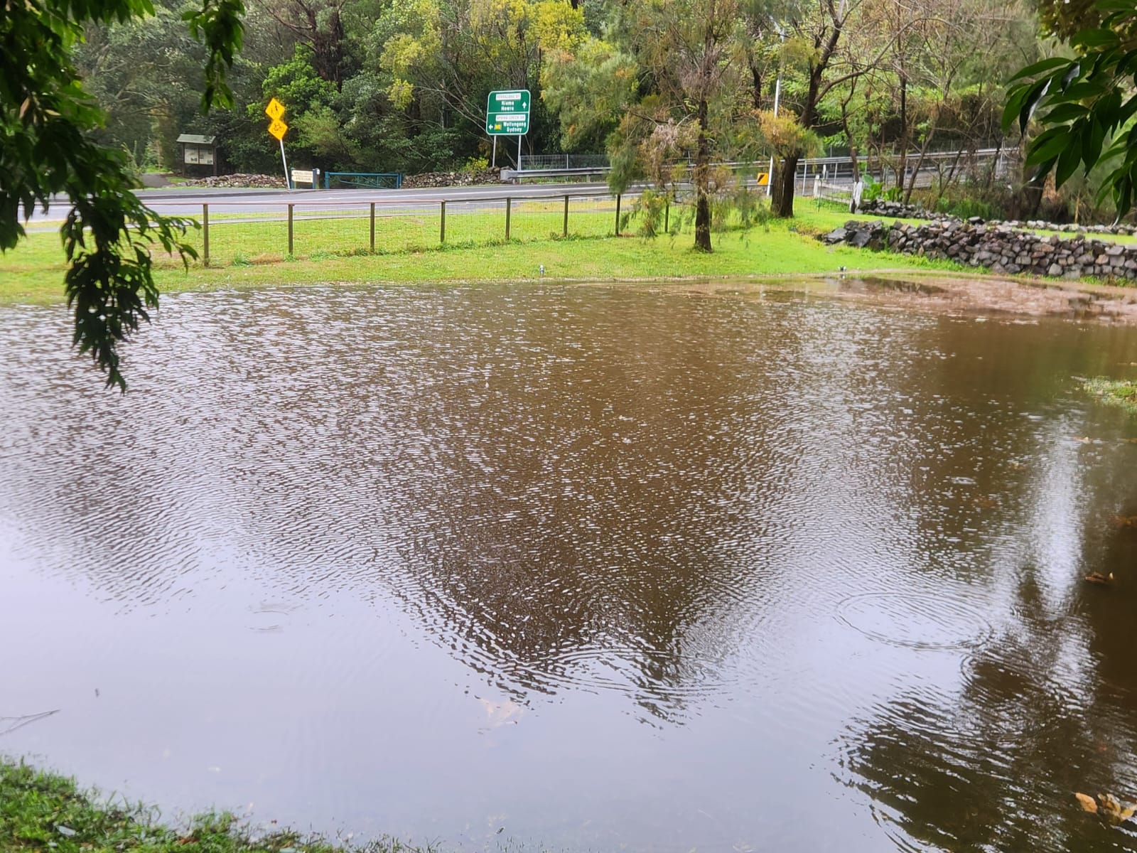
When it comes to addressing the impact of flooding at Spring Creek, the people who know best are the locals.
The call has been put out to residents who know the area to let Council know what kind of solutions they would like to see for the flood-prone area adjacent to the Kiama town centre.
Council has opened an online survey until the end of the month and will also hold an information session via Microsoft Teams next Tuesday (12pm-1pm on 12 August) and a drop-in session at the Joyce Wheatley Centre the following day (3.30pm-5.30pm on 13 August).
Darren Brady, Council’s director of infrastructure & operations, said they were keen to get feedback on how the area can be affected during rain events.
Flooding at Spring Creek typically affects residents by cutting off access to their properties via the Dido St bridge and it can also prevent motorists from travelling in each direction on Jamberoo Road.
Council is undertaking a flood study and completing a risk management plan to understand the flooding and determine strategies for mitigation options.
“We are looking to understand the public’s awareness of and experiences with flooding in Spring Creek, how the public responds to flood events as well as gather any local
information that can assist with the flood analysis and study,” Brady said.
“Local knowledge about flood behaviour, including areas prone to flooding, flood depths, flow paths, and the impact of flooding on properties and infrastructure is beneficial.
“We are also seeking feedback and general sentiment toward flood mitigation options.”
Environmental planning and infrastructure advisory experts Rhelm have been commissioned to undertake the Flood Study.
“The objective of this study is to improve our understanding of flood behaviour and impacts and better inform the management of flood risk in the area,” Brady added.
“The study focuses on updating the previous plan completed in 2014 to the latest Australian Rainfall and Runoff guidelines and methods required for flood analysis and to also include for future development in the catchment as identified in the recently adopted Local Housing Strategy.
“The study will also help develop a Flood Risk Management Plan which aims to identify, quantify and weigh the relevant risks to the community and the potential for mitigation options.”
As well as road closures, flooding in the area also leads to SES responses to emergency situations and damage to public infrastructure.
Climate change forecasts are for more frequent and higher intensity storm events and associated flooding which will be part of the revised flood study.
“A variety of options will be considered, including flood modification measures such as infrastructure works, property modification measures including development controls, and flood and emergency responses and management strategies,” Brady said when asked about options to mitigate the risk.
“If the Flood Study and subsequent Flood Risk Management Plan identify any infrastructure improvements required, Council will factor these into its future capital works program for implementation as budgets permit.
“The outcomes of the Flood Risk Management Plan will also allow Council to seek grant funding for the implementation of recommendations.”
NEWS